.jpg)
News
Published over 6 years ago. See the latest and most current information on News.
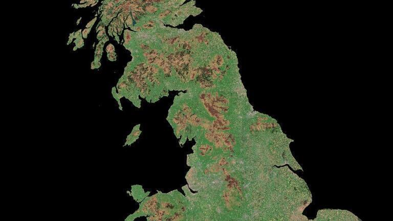
The University of Hertfordshire is on the brink of commercialising a new high-tech earth observation database that will create detailed images of the Earth’s surface, uninterrupted by cloud cover.
University spin-out DeepEO, planned to launch later this year, will create regular satellite mapping of the UK, in the visible and infrared bands free from cloud cover, for the first time by using satellite radar imaging. The project is led by Professor James Geach and PhD student Mike Smith.
The new start-up plans to integrate their cloud-free images into a live database combining land, ocean and atmospheric data. It will enable organisations such as government agencies and private businesses to predict environmental threats like flooding and wildfires; monitor coastal erosion; and track the impact of climate change on crop growth patterns. It can assist with faster and improved decision making, for example, predicting in advance when a river will burst its banks, so that appropriate precautionary action can be taken.
The original research conducted by the University of Hertfordshire was funded by Science and Technology Facilities Council. The university worked in partnership with Goonhilly Earth Station using their deep learning platform and incubator hub. This enabled rapid development of the product, greatly reducing the time taken to commercial roll out.
Chris Roberts, Head of Data Centre and Cloud at Goonhilly said: “Our wraparound service nurtures start-ups like DeepEO with the resources they need on their journey from a research project to commercial growth and profitability.”
DeepEO’s goal is to apply more innovative analysis techniques to gain valuable intelligence from the data and deliver it to target customers. These will include insurance firms, commodity traders, supermarkets and the agricultural industry. The team is already working with agritech company Agrimetrics to develop a pipeline for monitoring the health and growth rate of each of the UK’s 2.8 million fields on a weekly basis.
ILM 51.6 Sept 2026


 Product directory


.jpg)
.jpg)
























.jpg)