News
Published over 9 years ago. See the latest and most current information on News.
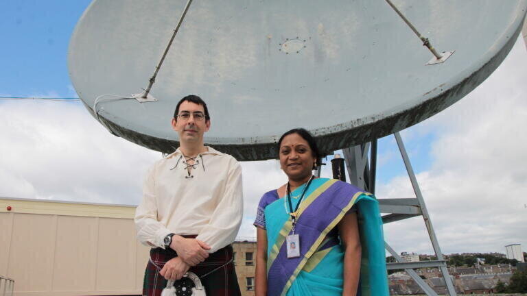
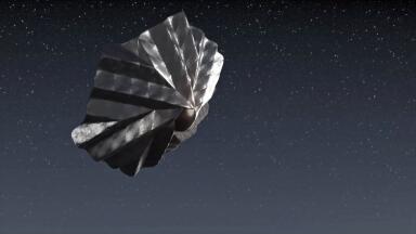
Dundee to provide data reception and processing for Indian Satellite
The University of Dundee has entered into an agreement with Antrix Corporation Limited, the commercial arm of the Indian Space Research Organisation (ISRO), to receive data from one of its Oceansat-2 Earth Observation (EO) satellite.
Engineers from Antrix/ISRO have visited the Dundee Satellite Receiving Station (DSRS), one of the UK’s main facilities for acquiring data from space, to install and test acquisition and generation systems and train DSRS engineers on operations to receive data.
The primary purpose of this collaboration is to collect and distribute these data to UK environmental scientists to support marine science research. More broadly, DSRS data are also used in areas such as meteorology and vegetation, snow/ice, volcano and earthquake research.
Historically, data received at Dundee have been provided by US and European satellites. The agreement with Antrix provides an opportunity to broaden the range of satellite data available to users and develop a new partnership with ISRO, another major satellite operator. DSRS will be only the second ground station outside India to receive Oceansat-2 data directly.
Dr Paul Crawford, of the DSRS, said, “We are delighted to be working with the Indian Space Research Organisation, who have made significant advances in the field in recent years. The data from this EO satellite are received and processed by their National Remote Sensing Centre near Hyderabad.
“At present, we will be one of only two sites outside of the Indian coverage area to receive and process the ocean colour image data directly and as such it will be a very useful addition to the other satellites we routinely take data from. Both sides look forward to continued cooperation for future satellite missions.”
DSRS works with Plymouth Marine Laboratory in operating the NERC Earth Observation Data Acquisition and Analysis Service (NEODAAS), which is funded by the National Centre for Earth Observation. NEODAAS provides real time and historic information generated from EO satellite data, such as chlorophyll levels and sea surface temperatures for marine scientists.
ILM Guide 2026/27


.jpg)